|
(Updated 11/08/2007)
 Kagnew Station Map. This is an ongoing project of
a Kagnew Station map, which will allow you to click a building and see all the
information and pictures of that building in one place! I will be adding to it
as I find time and building pictures. Kagnew Station Map. This is an ongoing project of
a Kagnew Station map, which will allow you to click a building and see all the
information and pictures of that building in one place! I will be adding to it
as I find time and building pictures.
Thanks to dependent Judy
Spencer for providing the map.
Special Note: Terry Hicks has
reproduced this map on a smaller scale, here is the link:
Terry Hick's
Map
Here's
another
map Terry for Radio Marina. |
|
Radio Marina Map. Bob Hart has
sent me a two-part hand tracing of Radio Marina he did while on CQ duty and
would like to share it with us. He is looking for the original to rescan and
we're going to try to create one map for you. This now gives us a map of both
stations!
And now there are two maps. Dick Lilienthal sends in another
map which he believes he got from Bill Cross. It is a little more detailed with
a legend for all the buildings. With the combination of the two maps I should
be able to put together a decent map of Radio Marina.
Thanks guys!
Rick |
|
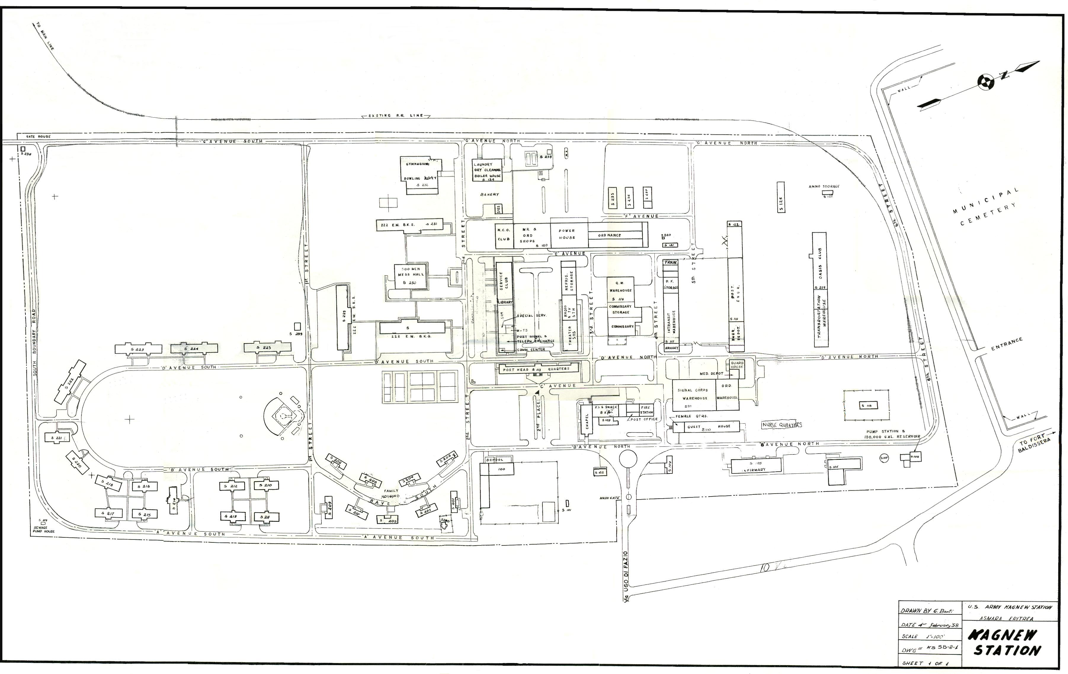
| Judy Spencer sent me a an original draft of a Kagnew map. It was
drawn by G. Berti, dated 4 February 1958! It does not have a lot of the newer
buildings from the 1960s but I want to use this map as a base and try to add
buildings as they are recognized. This is a large map (558KB - 3605 by 2275
pixels) so I am scanning it in pieces and then putting the pieces together like
a jigsaw puzzle, which is going to take some time. For now, you can see the
progress of the map here: Kagnew map courtesy
of Judy (Hord) Spencer, Dependent 1957-1960. (It may be better if you
download the map to your hard drive and view it there, especially if you're on
a dialup. Broadband users should have no problem.) |
|
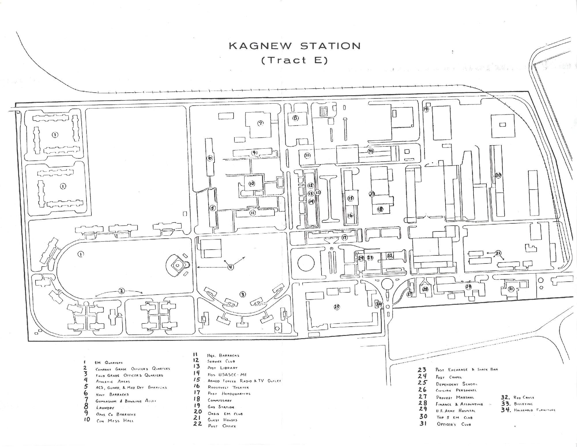
Large map of Kagnew (Tract E)
(269KB)
Revised Kagnew Map with legend by Dave
Handlin (60-62) |

